posted by Richard Gill
 Some bridges, such as this one above Wood Street, are badly deteriorated.
On Saturday, June 20, an organization named Friends of the Bloomingdale Trail hosted a walk/run/bike event to publicize their effort to create an urban trail on the right-of-way of a long-inactive railroad line.
Informally called the Bloomingdale Line, the railroad is elevated on retained earth-fill embankment, running east-west along its namesake street, at about 1800 North. The trail would essentially replace the track on the embankment from the Chicago River to about 3800 West. Neighborhoods traversed include Wicker Park, Bucktown, Logan Square and Humboldt Park. The neighborhoods seem to have adopted the railroad line and its structures.
For most of its existence, the Bloomingdale Line was an industrial freight branch of the Chicago, Milwaukee, St. Paul & Pacific Railroad. Some twenty years ago, ownership was transferred to the Minneapolis, St. Paul & Sault Ste. Marie Railroad. The Canadian Pacific Railroad is the present owner.
In the past few decades, many hiking/biking trails have been established on former rail lines in rural areas under various programs, such as Rails-to-Trails. The Bloomingdale Trail would be one of a few rail-trails right inside major cities. Saturday’s event was timed to help celebrate the June opening of New York City’s High Line, a path on an abandoned freight branch on the west side of Manhattan.
The Friends caught a break in the recent stormy weather; it was a beautiful hot, sunny day. So, with camera in hand, I set off on a two-hour walking excursion along a segment of the Bloomingdale Line.
As I walked, I was reminded that despite Hyde Park’s amenity envy vis a vis the North Side, at least we don’t have to struggle to acquire a trail. The best one in the city is right on our doorstep.


7 comments:
Billy Idol seems to have aged well.
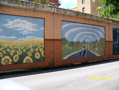
Kidding aside, this is a very cool photo-story. I even like the murals. Can we get those?
Some more info on the old rail lines of the near north side, including the Bloomingdale line discussed here.
http://www.chicagoswitching.com/v5/
Billy Idol?
Don't be silly. That's Richard Gill.
You mean the guy with the muscle shirt? It's my identical twin.
I guess I was unaware that the Bloomingdale "trail" is elevated in most places. The Tribune article pictured only a section of tracks that went through a wide, grassy area (it already looked like a park path). So in order to turn this into a usable trail, all these embankments and bridges would have to be refurbished to be structurally sound, as well as rehabbed aesthetically?
The grassy area was probably just a wide spot on top of the embankment where there used to be a siding or warehouse. The whole thing has pretty much gone back to nature. I'm no structural engineer, but I'd guess the bridges are structurally ok (at least as long as no trains run on them) but are shedding chunks of concrete. The railroad bridges in Hyde Park are also spalling, but they would not be allowed to carry trains if they were considered unsafe.
Old railroad bridges were generally over-designed because less was known about structural materials, and they had to support 300-ton reciprocating steam engines pounding away. Aaahh, those were the days!
I know of one segment of elevated railroad on Chicago's West Side, between about Rockwell and Kostner, that is out of service because the City condemned the bridges. The CSX railroad diverted the trains to other lines, and may leave it at that.
Another candidate for a bike trail is the St. Charles Air Line (map , wikipedia).
It now has both freight and passenger traffic. In a few months, the freight traffic will cease. In a few years, the passenger trains will go too.
Currently, there is no good way to bike/walk from the lakefront path to Chinatown and Pilsen. Here is how to fix that:
1) Convert the walkway over the 18th street metra stop into a proper bike path, which would connect to the north-south segment of right-of-way just north of the convention center
2) convert that segment, the east-west bit, and the bascule bridge to a bike path.
3) add exits at Wabash (to S. Loop), Wentworth (to Chinatown) and Canal (to Pilsen and UIC).
This would help integrate the fragmented neighborhoods of the near south side, and make Chicago much more bike friendly.
Post a Comment